
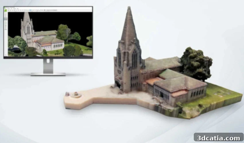
Unlocking Reality: The Ultimate Guide to Top Photogrammetry Software for 3D Modeling and Beyond
In the world of advanced manufacturing and digital design, the creation of accurate 3D models is a foundational step, particularly for 3D printing. While traditional methods like CAD software, other modeling tools, and dedicated 3D scanners have long been employed, a revolutionary technique called photogrammetry has rapidly gained popularity. This innovative approach harnesses the power of photographic images to generate precise 3D data, making it an indispensable tool for a wide range of applications, from engineering and architecture to cultural heritage preservation and, of course, 3D printing.
Photogrammetry fundamentally involves recording, measuring, and interpreting photographic images to obtain reliable spatial data about real-world objects and environments. Unlike traditional 3D scanning, which often requires specialized and sometimes costly hardware, photogrammetry can be remarkably accessible, often achievable even with a standard smartphone camera. This democratizes the process of 3D data capture, making it a highly attractive option for both professionals and hobbyists. Surveyors leverage it to create detailed topographic maps, architects and engineers utilize it for accurate site analysis and building renovation projects, and 3D printing enthusiasts find it invaluable for capturing large, complex objects with high fidelity. The ability to transform a series of 2D photographs into a fully textured 3D mesh or point cloud offers unparalleled flexibility and cost-effectiveness. In this comprehensive guide, we will explore some of the most prominent and effective photogrammetry software solutions available today, highlighting their unique features and best-fit applications, presented in no particular order.
Leading Photogrammetry Software Solutions for Diverse Needs
ReCap Pro by Autodesk
Developed by the renowned software giant Autodesk, ReCap Pro stands as a powerful reality capture solution, designed to convert a multitude of photographs into precise 3D models or accurate 2D drawings. Bearing a name derived from “Reality Capture,” this software is meticulously engineered to cater to the diverse demands of projects across surveying, urban planning, construction, and the detailed renovation of existing buildings and infrastructure. From a technical standpoint, ReCap Pro excels at generating high-quality point clouds or meshes that are readily compatible with other leading Autodesk applications and various CAD tools. This seamless integration streamlines workflows, allowing users to move from reality capture to design and analysis with ease.
The latest 2023 version of ReCap Pro introduces a suite of significant improvements and updates, enhancing both performance and user experience. These advancements include refined import and indexing capabilities for raw scan data, automatic terrain classification specifically optimized for large-scale infrastructure projects, and a notable boost in rendering quality. This improved rendering is achieved by dynamically increasing the number of displayed points based on the user’s system memory, ensuring richer visual detail. Autodesk offers ReCap Pro through several flexible paid subscription options, providing scalable solutions for individual professionals and large enterprises alike.
3DF Zephyr
3DF Zephyr, a sophisticated software solution from 3DFlow, offers advanced automatic 3D reconstruction capabilities, independent of the input device. Whether you’re utilizing a standard camera, a drone, or even integrating laser scanner data, 3DF Zephyr can seamlessly process your input to generate highly accurate 3D models. This professional-grade photogrammetry software not only simplifies the creation of detailed 3D scans but also empowers experienced users with extensive tools for fine-tuning and optimizing their results. Users can export their models into a wide array of file formats, ensuring compatibility with virtually any other 3D software or CAD program.
One of 3DF Zephyr’s standout features is its ability to combine photogrammetry data with laser scans. This hybrid approach significantly enhances precision, allowing for the capture of intricate details and overall geometric accuracy that might be challenging with either method alone. The software is designed to facilitate smooth integration with other CAD programs, making it an excellent choice for complex design and engineering projects. While a free version of 3DF Zephyr is available, it comes with a limitation of 50 images for 3D reconstruction. For more extensive projects and advanced functionalities, 3DFlow provides a range of paid versions, each offering different features and capabilities tailored to varying professional needs.
RealityCapture
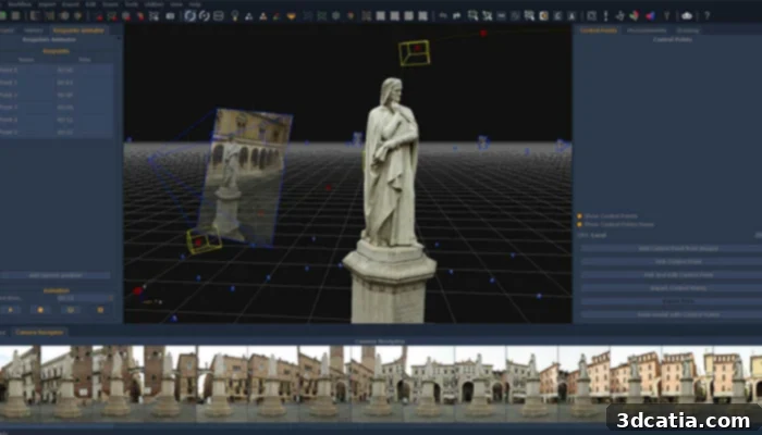
RealityCapture, developed by CapturingReality, is an exceptionally fast and versatile photogrammetry software renowned for its ability to work with a wide variety of input media, including images and laser scans. This powerful tool allows users to transform raw data into a diverse range of high-quality 3D outputs, such as immersive virtual reality scenes, intricately textured 3D meshes, precise orthographic projections, and geo-referenced maps. Its capability to seamlessly integrate laser scan data alongside photographic input provides an added layer of accuracy and detail, making it an ideal choice for projects demanding the highest levels of geometric fidelity.
The software boasts a clean, modern, and highly intuitive user interface, which significantly lowers the barrier to entry for newcomers while still providing the depth of control that experienced professionals require. This user-friendly design ensures that even those new to photogrammetry can quickly become proficient in creating complex 3D models. RealityCapture offers a flexible pricing structure with four distinct plans, catering to a broad spectrum of users. These plans range from options suitable for casual users and small-scale projects to robust solutions designed for large enterprise-level business projects, ensuring that users can select a plan that perfectly aligns with their specific needs and budget.
ContextCapture
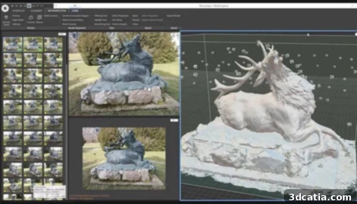
Bentley’s ContextCapture is a leading photogrammetry software that empowers users to generate highly detailed and accurate 3D reality models directly from ordinary photographs. This makes it an invaluable asset for any infrastructure project, from urban planning to large-scale construction. For enhanced precision, ContextCapture allows for the seamless integration of points derived from laser scans, enabling the capture of incredibly fine details, sharp edges, and superior geometrical accuracy in the resulting 3D models. The software is engineered to rapidly create and utilize these highly detailed 3D reality meshes, providing a true and precise context that informs critical design, construction, and operational decisions throughout the entire project lifecycle.
ContextCapture is exceptionally versatile, capable of reliably and quickly producing 3D models at any scale, whether the object measures a few centimeters or encompasses entire cities. The accuracy of the final 3D model is primarily limited only by the resolution and quality of the input images provided by the user. A significant advantage of Bentley’s ContextCapture is its ability to minimize unnecessary resource expenditure on additional equipment and specialized training. Users can simply employ a standard smartphone camera to capture the necessary images and then leverage the software’s powerful processing capabilities to model their project, making advanced reality modeling more accessible and cost-effective.
Agisoft Metashape
Agisoft Metashape is a robust, professional photogrammetry software acclaimed for its ability to process digital images across a wide array of applications. Its versatility makes it suitable for Geographic Information System (GIS) applications, detailed cultural heritage documentation, creating stunning visual effects for film and gaming, and precise indirect measurements of objects at various scales. Metashape boasts several crucial features that enable it to efficiently process diverse types of imagery, whether captured aerially via drones or through close-range photography.
Key functionalities include the generation of dense point clouds, precise measurement of distances, areas, and volumes, and the creation of highly detailed 3D meshes. These meshes can then be exported to numerous popular 3D file formats, ensuring broad compatibility with other design and analysis software. A particularly advanced feature is its capability to edit 4D models, which means entire dynamic scenes can be captured in 3D over time and then manipulated within the software, opening up new possibilities for animation and temporal analysis. Agisoft Metashape is available in two distinct editions: a professional version for advanced users and large-scale projects, and a standard option, with price points that reflect their respective feature sets and target audiences.
AliceVision Meshroom
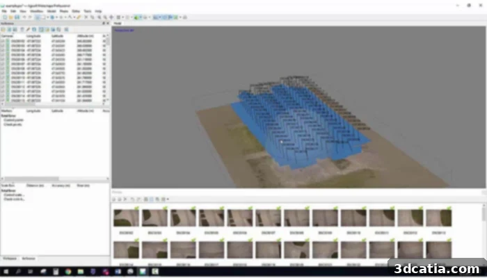
Meshroom, powered by AliceVision, represents a highly accessible and powerful free and open-source 3D reconstruction software. This innovative tool leverages a series of photographs to automatically generate detailed textured meshes, which form the structural foundation of your 3D model. AliceVision itself is a comprehensive photogrammetric computer vision framework, built upon the collaborative efforts of a dedicated community. This community actively invests in the creation and continuous improvement of open-source software solutions like Meshroom, making advanced 3D modeling techniques available to a wider audience.
As an open-source project, Meshroom benefits from community contributions, ensuring ongoing development and support. It provides an excellent entry point for students, hobbyists, and professionals looking for a robust and cost-free photogrammetry solution. The software handles various stages of the photogrammetry pipeline, including camera tracking, mesh generation, and texturing, all within a user-friendly node-based interface. Its open nature also means that users with programming knowledge can customize and extend its functionalities. For those eager to delve deeper into its capabilities and understand its workflow, a comprehensive video tutorial is often available and highly recommended.
Colmap
Colmap is a remarkably versatile and powerful software suite that combines Structure-from-Motion (SfM) and Multi-View Stereo (MVS) algorithms. It provides both a user-friendly graphical interface (GUI) and a robust command-line interface (CLI), catering to different user preferences and automation needs. Designed for comprehensive 3D reconstruction, Colmap offers an extensive range of features for processing both ordered and unordered collections of images, making it adaptable to various capture scenarios, from structured scans to more spontaneous photo sets.
Operating under the permissive new BSD license, Colmap is an open-source solution that has gained significant traction in academic and research communities. Its foundation is built upon existing works and established computer vision algorithms. A key aspect of using Colmap is the requirement for users to cite the original authors when applying specific algorithms or publishing results derived from the software. This practice underscores its academic roots and commitment to intellectual acknowledgment. Colmap’s capabilities extend to producing dense point clouds and high-quality 3D reconstructions, making it a valuable tool for researchers, developers, and anyone needing a flexible and powerful open-source photogrammetry platform.
DroneDeploy
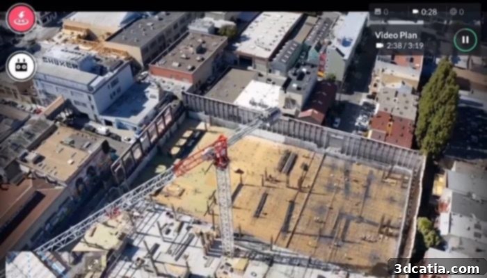
DroneDeploy is a comprehensive, cloud-based solution specifically engineered for building highly accurate aerial maps and 3D models using images captured by DJI drones and other compatible unmanned aerial vehicles. Developed by the San Francisco-based company, this software empowers drone operators to quickly and efficiently create detailed aerial outputs, transforming raw photographic data into actionable insights. Its user-friendly mapping interface is designed to be accessible for both beginners and advanced users, ensuring a smooth and productive experience.
A key differentiator for DroneDeploy is its array of autonomous flight features, seamlessly integrated and controllable via the DroneDeploy mobile app. These features simplify complex mapping missions, allowing drones to follow predefined paths for consistent data capture. Beyond mapping, the software offers a wealth of useful functions, including various types of in-field data analysis, enabling users to gain immediate insights from their aerial data. It excels at generating precise 2D maps (orthomosaics), detailed 3D models, and even immersive 360-degree panoramas. These outputs can be effortlessly shared with entire teams or directly with clients, facilitating collaboration and communication. DroneDeploy provides a range of flexible pricing models tailored for individual use or larger teams, ensuring scalability. Additionally, a free, one-month trial version is available, allowing prospective users to explore its extensive capabilities before committing.
Pixpro
Pixpro, meticulously developed by Pixpro UAB, is a versatile photogrammetry software solution capable of creating high-quality maps and detailed 3D models from photos captured by virtually any drone or camera. Designed with both seasoned professionals and absolute beginners in mind, Pixpro prioritizes ease of use and mastery through its intuitive user interface and a familiar, layer-based system. This comprehensive software offers robust cloud processing capabilities, ensuring consistent and identical results regardless of the specific Windows PC or laptop hardware being used, which is a significant advantage for collaborative projects and diverse work environments.
Pixpro’s main features are geared towards efficiency and accuracy. These include instant 2D and 3D measurement tools, highly optimized ground control point (GCP) workflows that facilitate accurate mapping of large geographical areas, and the ability to export all generated or drawn layers for further use in other software. Furthermore, the software comes equipped with a suite of built-in post-processing tools, such as downsampling, smoothing, and decimation. These tools are invaluable for optimizing and streamlining 3D models, ensuring maximum compatibility with other design, analysis, and visualization software. Pixpro offers various flexible software purchase plans, making it accessible with starting prices as low as 5 euros per month, catering to different project scales and budget constraints.
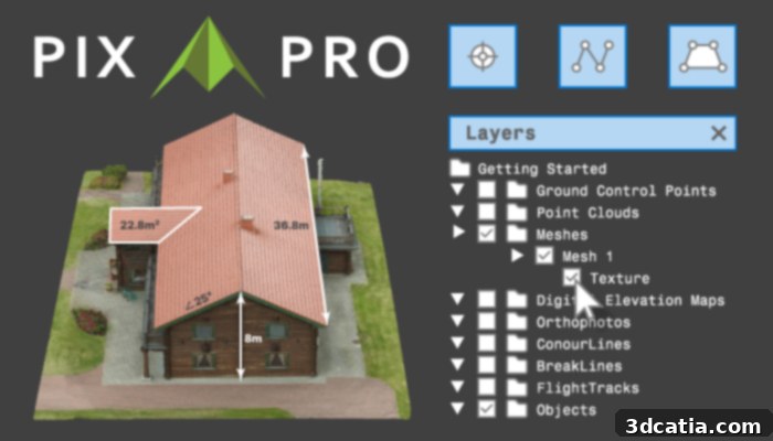
Photo Credits: Pixpro UAB
Mic Mac
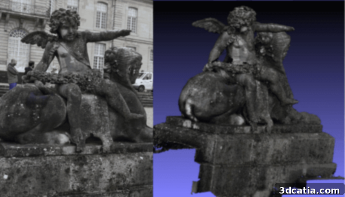
Mic Mac is a distinguished free and open-source photogrammetry software specifically developed for high-quality 3D reconstruction. Its origins trace back to 2003, where it was created through a collaborative effort at the Instituto Nacional de Información Geográfica y Forestal (IGN) and the Escuela Nacional de Ciencias Geográficas (ENSG). Initially, Mic Mac was exclusively designed for IGN’s internal cartographic production, operating with a proprietary image file format. However, a significant transformation occurred in 2010 when its XML interface was replaced by a simplified command-line interface. This change dramatically increased its accessibility and facilitated its dissemination to a broader community of users and researchers.
Beyond its open-source nature, Mic Mac is renowned for its cross-platform compatibility, being available for Windows, Mac OSX, and offering GPU processing capabilities for specific, compute-intensive tasks, which significantly speeds up processing times. One of the most compelling aspects of Mic Mac is its versatility in user experience; it is designed to be effectively used by beginners seeking an introduction to photogrammetry, experienced users requiring advanced tools, and experts pushing the boundaries of 3D reconstruction. This broad appeal and robust functionality have led to its extensive adoption in numerous significant French and European projects, solidifying its reputation as a reliable and powerful photogrammetry solution for diverse applications.
Open Drone Map
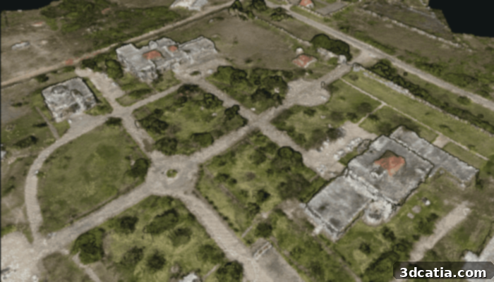
Open Drone Map (ODM) is a powerful, open-source software solution dedicated to processing images captured by drones, transforming them into valuable 3D geographic data suitable for integration with other spatial datasets. As part of a larger open ecosystem for aerial data, ODM provides a flexible and cost-effective alternative to commercial software. Its comprehensive feature set includes the generation of high-density point clouds, detailed digital surface models (DSMs), and richly textured digital surface models, among other outputs crucial for mapping, surveying, and environmental monitoring.
While Open Drone Map is primarily built on Ubuntu 16.04, its versatile architecture allows it to be deployed and run on other operating systems with the use of Docker containers. This flexibility ensures that a wider range of users can leverage its capabilities regardless of their preferred platform. The software is capable of producing a variety of valuable products, including geometrically accurate 3D meshes, seamless orthophotos (geometrically corrected aerial photographs), and dense point clouds that provide a detailed representation of the captured environment. Being open-source, ODM benefits from a vibrant community of developers and users, constantly evolving and improving its functionalities, making it a robust choice for anyone looking to process drone imagery for 3D modeling and mapping applications.
PhotoModeler Technologies
PhotoModeler Technologies offers a highly regarded photogrammetry software that continues to evolve, providing users with sophisticated tools for precision 3D modeling from photographs. The year 2022 saw significant advancements with the release of updates 2022.1 (on February 16, 2022) and 2022.0, collectively introducing over 100 improvements and enhancements. These updates were strategically focused on bolstering the software’s capabilities in key sectors, particularly marine work, forensics, and accident reconstruction, demonstrating a commitment to addressing specific professional needs.
Among the notable new features are convenient shortcut keys designed to streamline common tasks, such as exporting data or drawing intricate curves, significantly improving workflow efficiency. A major enhancement is the introduction of more user-friendly surface drawing functionalities. This means that within modes like line or curve drawing, existing surface points can now be intuitively moved by simply dragging or clicking them. This innovative approach makes it considerably easier to edit, adjust, and correct points directly within the surface drawing mode, eliminating the need to constantly switch between different tools and maximizing productivity. PhotoModeler is available in both standard and premium versions, offering scalable features to meet the varying demands of different projects and professional users.
Regard3D
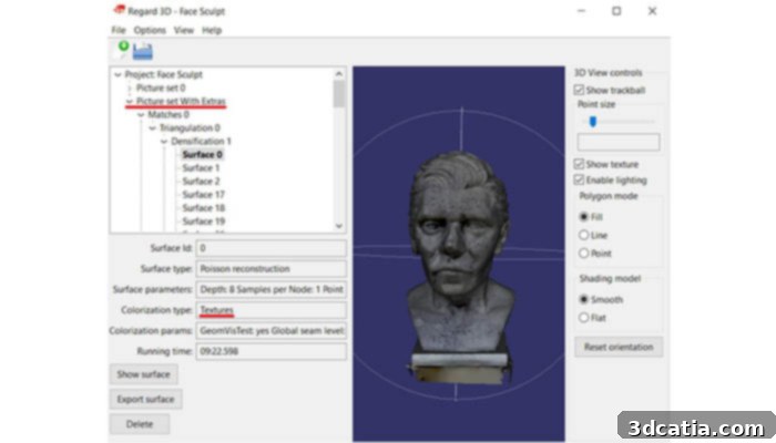
Regard3D stands out as another excellent free and open-source software solution, specifically classified as a ‘structure-from-motion’ program. Its core functionality revolves around the remarkable ability to convert a series of digital photographs of an object, captured from various angles, into a highly accurate 3D model of that object. This powerful tool provides an accessible entry point into photogrammetry without the burden of licensing fees, making it an ideal choice for students, hobbyists, and professionals seeking a cost-effective solution.
One of Regard3D’s significant advantages is its cross-platform compatibility, allowing users to run the software seamlessly on multiple operating systems, including Windows, OS X, and Linux. This broad support ensures a wider user base can benefit from its capabilities. The software leverages powerful third-party tools and libraries, ensuring robust performance and feature richness. For those new to the program, the official website serves as a valuable resource, offering not only the software download but also a comprehensive collection of tutorials. These tutorials are designed to help users quickly familiarize themselves with the program’s interface and workflow, facilitating a smooth learning curve. Furthermore, Regard3D benefits from regular updates, reflecting ongoing development and improvements, which contributes to its reliability and expanding feature set.
WebODM
WebODM is an intuitive and user-friendly software solution specifically designed for processing aerial images captured by drones, transforming them into a variety of valuable 3D outputs. This includes precise elevation models, richly textured 3D models, geo-referenced maps, and dense point clouds. As a project stemming from OpenDroneMap, WebODM is an integral part of an expansive open ecosystem dedicated to the comprehensive workflow of collecting, processing, analyzing, and displaying aerial data, emphasizing accessibility and community collaboration.
A key benefit of WebODM is its design for offline functionality. Once the drone photogrammetry program is downloaded and installed on your computer, it runs locally, allowing for continuous processing even without an internet connection – a crucial feature for fieldwork in remote locations. This self-contained operation ensures data privacy and control. While the software itself is open-source, the installation and ongoing technical support are offered at a one-time fee of $57. This payment covers initial setup assistance and access to support resources, eliminating recurring monthly payments and providing a cost-effective solution for professionals and enthusiasts. For a more visual and in-depth understanding of WebODM’s functionalities and installation process, a detailed video tutorial is readily available.
Pix4D
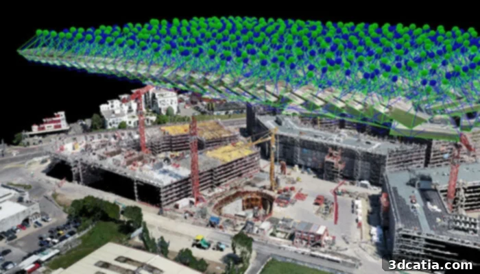
Pix4D is a leading developer of photogrammetry software, offering a comprehensive suite of solutions tailored to meet the diverse needs of various users and industries. The company’s innovative tools enable the precise measurement and analysis of data captured from a wide range of sources, including drones, handheld cameras, and even manned aircraft. Currently, Pix4D provides five distinct mapping and 3D modeling software packages, each optimized for specific applications and user requirements.
Among its flagship offerings is PIX4Dmapper, a professional-grade solution specifically designed for users employing drones or other cameras for mapping purposes. PIX4Dmapper allows users to seamlessly integrate any type of imagery, whether it’s standard RGB, thermal, or multispectral data. Following the digitization and processing steps, users gain the ability to accurately measure surfaces, volumes, and distances within their generated 3D models. Beyond PIX4Dmapper, the company also offers specialized photogrammetry tools such as PIX4Dmatic, which is expertly engineered for rapid and efficient large-scale land mapping. This focus on specialized solutions ensures that Pix4D can provide targeted, high-performance tools for a broad spectrum of geospatial and modeling professionals.
Trimble Inpho
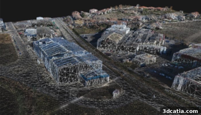
Trimble Inpho, offered by Trimble Geospatial, stands as one of the preeminent software solutions in the field of digital photogrammetry. This powerful software is meticulously designed for processing aerial images, transforming raw photographic data into highly accurate and actionable geospatial products. It excels at generating dense point clouds, precise surface models, seamless orthophoto mosaics, and digitized 3D features, all essential components for advanced mapping and surveying applications.
Trimble Inpho is recognized as a remarkably reliable and robust solution, largely due to Trimble Geospatial’s extensive experience in the market. With over 30 years dedicated to developing cutting-edge geospatial technologies, the company has cultivated a deep understanding of the industry’s demands, enabling them to offer a highly refined and stable photogrammetry platform. This long-standing expertise ensures that Inpho users benefit from a mature, well-tested, and continuously improved software suite capable of handling complex projects with confidence. Its focus on aerial imagery processing makes it an invaluable tool for government agencies, surveying companies, and engineering firms requiring top-tier accuracy and efficiency in their geospatial workflows.
Choosing the Right Photogrammetry Software
Selecting the ideal photogrammetry software depends heavily on your specific project requirements, budget, and level of expertise. For beginners, open-source options like AliceVision Meshroom or Regard3D provide a great starting point to learn the fundamentals without financial commitment. Professionals tackling large-scale infrastructure projects, precise surveying, or intricate 3D printing tasks might gravitate towards robust commercial solutions like Autodesk ReCap Pro, ContextCapture, Agisoft Metashape, or Pix4D, which offer advanced features, dedicated support, and higher processing power.
Consider factors such as the types of input data you’ll be using (e.g., drone imagery, smartphone photos, laser scans), the required accuracy and detail of your 3D models, and the output formats needed for integration with other software (CAD, GIS, 3D animation). Cloud-based solutions like DroneDeploy and Pixpro offer scalability and ease of access, while desktop applications provide more control over processing parameters and potentially faster results for local hardware. Evaluate the learning curve, available tutorials, and community support for open-source options, or the comprehensive technical support and training offered by commercial vendors. Ultimately, the best software is one that efficiently meets your project’s demands while aligning with your technical skills and financial resources.
We hope this comprehensive listing of leading photogrammetry software solutions provides valuable insights for your 3D modeling and printing endeavors. Whether you’re a professional seeking high-precision tools or an enthusiast exploring the exciting world of reality capture, there’s a photogrammetry software out there for you. What are your thoughts on these tools? Do you have a favorite or a recommendation we missed? Let us know in a comment below or connect with us on our LinkedIn, Facebook, and Twitter pages!
Don’t forget to sign up for our free weekly Newsletter here to get the latest 3D printing news delivered straight to your inbox! You can also find all our engaging videos and tutorials on our YouTube channel, offering even more valuable content to enhance your understanding of 3D technologies.