Software
Photogrammetry: What is it and How is it Used in 3D Printing?
Photogrammetry is a technique for obtaining reliable data from real-world objects in the their natural state by creating 3D models from photographs. 2D and 3D data is extracted from an image and, thanks to overlapping photos of the object, building…
- 3 min read
- Software
- Six more stories
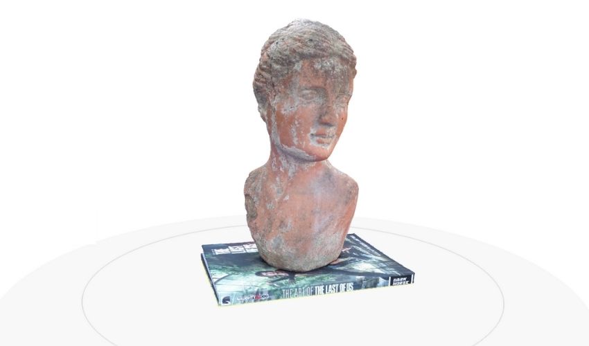
Photogrammetry is a technique for obtaining reliable data from real-world objects in the their natural state by creating 3D models from photographs. 2D and 3D data is extracted from an image and, thanks to overlapping photos of the object, building or terrain, is converted into a 3D digital model. This makes it possible to capture large objects, even landscapes, that would otherwise be impossible to scan. Photogrammetry is therefore often used by surveyors, architects and engineers to create topographic maps, networks or point clouds.
The role of photogrammetry is very important especially in topography. There are many advantages of photogrammetry when compared to classic topographical tools. For example, photogrammetry is both faster and more agile when it comes to data collection. It is also possible to get renderings of difficult to access terrain, especially nowadays, when the use of drones in photogrammetry makes it possible to reach all kinds of places. All the details of the terrain can be continuously mapped through the obtained photographs.
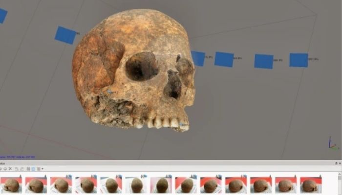
One of the uses of photogrammetry is in the world of archaeology (photo credits: PAR – Archaeology and National Heritage)
Photogrammetry’s Use in 3D printing
As we mentioned at the beginning, photogrammetry is the technology that allows us to create 3D models of real objects from photographs. The process is as follows: a series of photographs are taken around the object and then, using specific software, these are converted into a 3D model. By taking photographs (or videos) of the object from different perspectives and under constant lighting, the specialized software is able to find representative or characteristic points of the model that are repeated in all the photos. In addition, with a couple of photographs we can create the so-called stereoscopic effect which is necessary to infer the height of any object on the earth’s surface based on the shadows cast by each object, which allows us to increase the accuracy of the scan.
More from the desk
Six other notes from the rest of the bench.
 GuidesInterview with Hargurdeep Singh about his role at CAD MicroSolutionsCAD MicroSolutions is dedicated to helping mechanical and electronic customers ensure they are realizing the greatest value from their technology investment. The company offers design automation software, training, and consulting to help clients innovate, disrupt, design, and suc
 GuidesBeyond Recruiter Buzzwords: How 20 Years in Additive Manufacturing Shapes Modern HiringIf you’ve been following 3Dnatives, you’ve probably come across Gil Lavi before. We first profiled him and his company, 3D Alliances, back in 2019, and again in 2024 when 3D Alliances launched IMPACT, a program to help additive manufacturing companies optimize their channel netwo
 GuidesTop 10 Applications of 3D Printing in Art3D printing gives a completely new meaning to the saying “art knows no boundaries,” proving that new technologies and creativity are in fact very compatible, contrary to popular belief. Because the use of additive manufacturing allows artists to go one…
 GuidesWhich European Car Manufacturers Are Using 3D Printing?More and more car manufacturers are adopting 3D printing to improve their production processes and offer more personalized vehicles. Whether for electric cars, mass-market models, or luxury cars, 3D technologies are part of the value chain, and have become one…
 NewsAurora Labs uses its Rapid Manufacturing Technology to print metal 55 times fasterThe Australian metal 3D printer manufacturer Aurora Labs has recently revealed successful test results of its metal additive manufacturing process Rapid Manufacturing Technology (RMT). This came after the company closed a $5 million round of investment (before costs) from institu
 Materials3D Printing Bacteria: the New 3D Printing MaterialResearchers at the Zurich Institute of Technology (ETH Zurich) have developed a bio-ink for 3D printing bacteria. This breakthrough could lead to the production of biomedical cellulose or biological materials capable of destroying toxic substances. Researchers have developed a 3D